One photo
Shoot the pole from the ground. One frame is the whole measurement.
Field-first
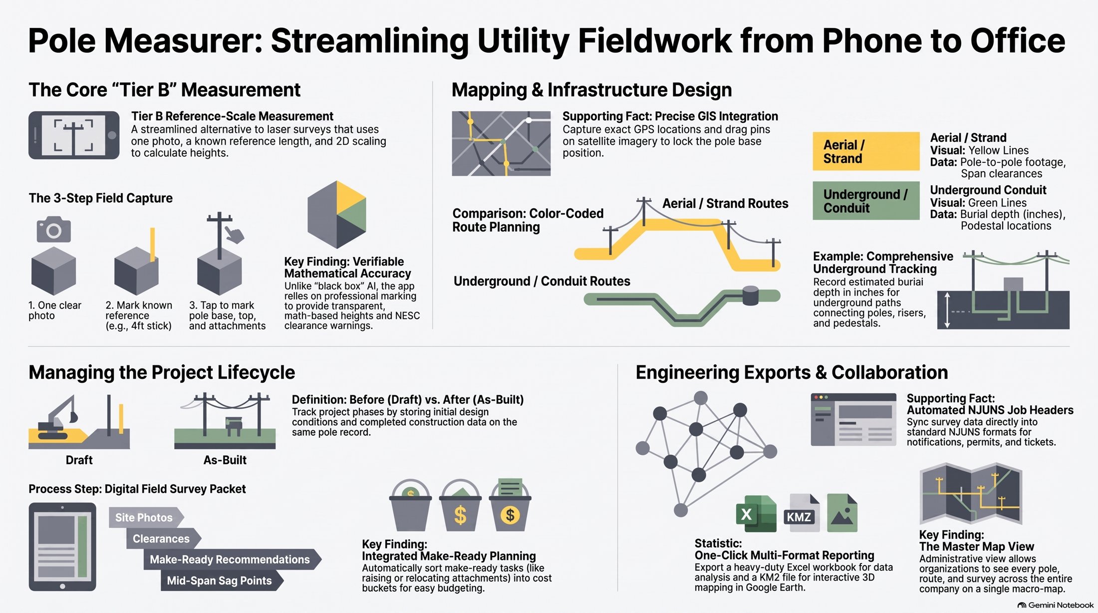
One pole photo, a known-length reference, and NESC clearance checks — saved to the job. No laser. No multi-station capture.
Built for joint-use, make-ready, and field crews.
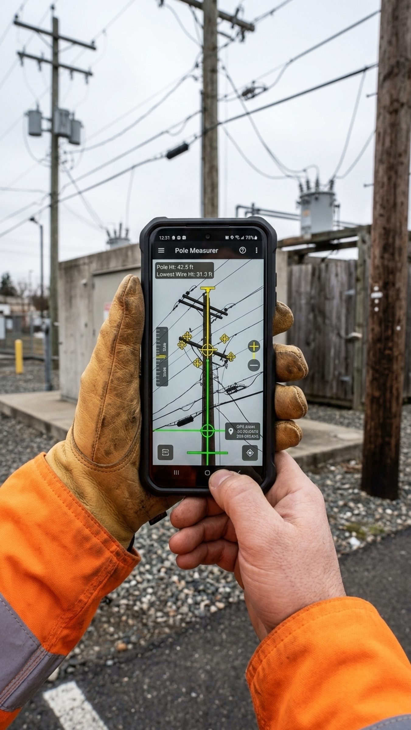
Shoot the pole from the ground. One frame is the whole measurement.
Mark a length you already know — a stick on the first attachment works best.
Base, top, and attachments. The app scales pixels into checkable heights.
Heights get recaptured because the last set of notes never lined up with the photo.
Pole photos live on phones, not on the job, so the office cannot see what the crew saw.
Make-ready, mid-span, pedestals, and NJUNS sit in different places — or on paper.
Remakes, clearance misses, and a job file nobody wants to stand behind.
From phone to office
Capture on the pole. Map aerial and underground. Hand the office a packet they can export — not a camera roll.
The method
Photograph the pole, mark a known length, and get scaled heights plus NESC-style clearance checks. Save poles, field surveys, project photos, and underground spans to one account the crew can share.
Field walkthrough
Honest method
Take or upload a pole picture. No extra stations, lasers, or depth sensors.
Mark a length you already know — a measure stick on the first attachment works best — and the app scales the rest of the pole.
Clearance screening runs against the same marks you placed on the photo.
Drop the pole on the map so the office sees where the work actually is.
Output
Poles, lean photos, site pictures, field surveys, mid-span, pedestals, and NJUNS live together — so make-ready is not a pile of texts and camera rolls.
Group poles and photos by job instead of by whoever took the last picture.
Walk the span, capture mid-span and underground, and keep it on the same map.
See the work in one place. Contributors stay on their own records.
Invite the crew so the job file is shared, not forwarded.
Direct. Practical. Precise. — clearance work starts with a photo you can measure.
Get started
Create an account and measure the next pole from a photo.
